ViewTube

ViewTube
Sign inSign upSubscriptions
Filters

Upload date

Type

Duration

Sort by

Features

Reset

141 results

MikeIvisonGIS
Ep1: Code a Day - GIS Programming - Until I Get Hired

We're working our way through "Introduction to GIS Programming" by Qiusheng Wu. In this episode, we're setting up a custom ...

10:41
Ep1: Code a Day - GIS Programming - Until I Get Hired

19 views

4 weeks ago

MikeIvisonGIS
Ep 2: Code a Day - GIS Programming - Variables

We're working our way through "Introduction to GIS Programming" by Qiusheng Wu. In this episode, we're working though the ...

15:13
Ep 2: Code a Day - GIS Programming - Variables

16 views

3 weeks ago

Native GIS
How to Map Population Density Using Python + WorldPop (Full Guide) 📊

How do you actually map population density at scale? In this video, I break down the complete GIS workflow for creating a ...

33:55
How to Map Population Density Using Python + WorldPop (Full Guide) 📊

266 views

3 weeks ago

MikeIvisonGIS
Ep 3: Code a Day - GIS Programming - Data Structures

We're working our way through "Introduction to GIS Programming" by Qiusheng Wu. In this episode, we're working though the ...

25:17
Ep 3: Code a Day - GIS Programming - Data Structures

8 views

3 weeks ago

Datum Decode
How to Create Interactive Airbnb Hotspot Maps Using Python & Folium | Full Geo Data Viz. Tutorial 🔥📍

Learn how to create interactive Airbnb hotspot maps using Python, Folium, and Geo-Visualization techniques — step-by-step and ...

27:22
How to Create Interactive Airbnb Hotspot Maps Using Python & Folium | Full Geo Data Viz. Tutorial 🔥📍

6 views

3 weeks ago

Open Geospatial Solutions
Interactive Segmentation of Remote Sensing Imagery with Meta's SAM 3

This makes geospatial analysis faster, more intuitive, and more accessible, whether you're mapping buildings, water bodies, ...

13:12
Interactive Segmentation of Remote Sensing Imagery with Meta's SAM 3

1,104 views

2 weeks ago

MikeIvisonGIS
Ep 4: Code a Day - GIS Programming - String Operations

We're working our way through "Introduction to GIS Programming" by Qiusheng Wu. In this episode, we're working though the ...

52:15
Ep 4: Code a Day - GIS Programming - String Operations

0 views

2 weeks ago

Surveying Solutions
Getting Started with Python for GIS | Coordinates, Data Structures, and Distance Calculation

Getting Started with Python for GIS | Coordinates, Data Structures, and Distance Calculation This beginner-friendly guide ...

6:07
Getting Started with Python for GIS | Coordinates, Data Structures, and Distance Calculation

94 views

6 days ago

PyData
Jaya Venkatesh-Accelerating Geospatial Analysis with GPUs-PyData Boston 2025

Geospatial analysis often relies on raster data, n‑dimensional arrays where each cell holds a spatial measurement. Many raster ...

36:27
Jaya Venkatesh-Accelerating Geospatial Analysis with GPUs-PyData Boston 2025

187 views

8 days ago

MikeIvisonGIS
Ep 5a: Code a Day - GIS Programming - Loops and Conditions

We're working our way through "Introduction to GIS Programming" by Qiusheng Wu. In this episode, we're working though the ...

38:44
Ep 5a: Code a Day - GIS Programming - Loops and Conditions

0 views

2 weeks ago

Matt Forrest
Desktop GIS Is Slowing You Down. GeoPandas Isn't.

GeoPandas is one of the most important tools in modern GIS, but many people still aren't sure when to use it, why it matters, ...

15:55
Desktop GIS Is Slowing You Down. GeoPandas Isn't.

1,241 views

2 weeks ago

The Debug Zone
How to Match Data Frames by Shortest Geographic Distance in Python

In this video, we will explore a powerful technique for matching data frames based on geographic proximity using Python.

1:59
How to Match Data Frames by Shortest Geographic Distance in Python

1 view

13 days ago

Matt Forrest
Do You Actually Need Esri Today?

ArcGIS Pro has been the center of GIS workflows for decades but how does it hold up in a world moving toward open, cloud-native ...

22:11
Do You Actually Need Esri Today?

2,868 views

4 weeks ago

Open Geospatial Solutions
Automated Segmentation with Image Captioning + Meta's SAM 3

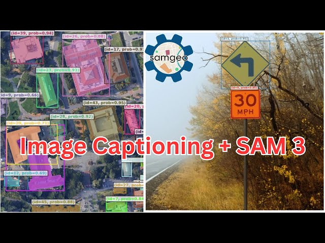
Automated Segmentation with Image Captioning + Meta's SAM 3 Speed up your geospatial analysis using AI-powered image ...

17:22
Automated Segmentation with Image Captioning + Meta's SAM 3

928 views

2 weeks ago

The Slop Temple
How to Use Python in Qgis (easy Method)

How to Use Python in Qgis (easy Method) | Surfshark VPN Deal — Stay private and secure. $1.99/mo + 3 Months Free ...

1:49
How to Use Python in Qgis (easy Method)

0 views

2 weeks ago

Geomatics Engineering Nepal
Satellite Image Compositing using Python | Jupyter Notebook Tutorial Anaconda Env (Step-by-Step)

... and Python-based geospatial analysis. Don't forget to subscribe for more tutorials on Python, GIS, and Remote Sensing!

42:49
Satellite Image Compositing using Python | Jupyter Notebook Tutorial Anaconda Env (Step-by-Step)

0 views

3 weeks ago

Geojay GIS Solution
Complete Step by Step Land Use Land Cover Supervised Classification in Google Earth Engine: GEE 2026

Don't forget to like, share, and subscribe for more tutorials on remote sensing and geospatial analysis! Join us on this exciting ...

22:37
Complete Step by Step Land Use Land Cover Supervised Classification in Google Earth Engine: GEE 2026

71 views

1 day ago

MikeIvisonGIS
Ep 5b: Code a Day - GIS Programming - Loops and Conditions

We're working our way through "Introduction to GIS Programming" by Qiusheng Wu. In this episode, we're working though the ...

52:01
Ep 5b: Code a Day - GIS Programming - Loops and Conditions

0 views

2 weeks ago

GIS & RS Made Easy
How to Create NDVI from Sentinel-2 in ArcGIS Pro Using Google Earth Engine (Python Tutorial)

In this video, I show you how to generate a Sentinel-2 median composite, create a True Color visualization, calculate NDVI, and ...

5:31
How to Create NDVI from Sentinel-2 in ArcGIS Pro Using Google Earth Engine (Python Tutorial)

138 views

4 weeks ago

Milan's Data Stories
30 Days, 30 Maps - My Full #30DayMapChallenge 2025 Tool Summary

From geospatial analysis to data visualization, remote sensing, modeling, animation, and interactive mapping, this overview ...

8:10
30 Days, 30 Maps - My Full #30DayMapChallenge 2025 Tool Summary

77 views

3 weeks ago